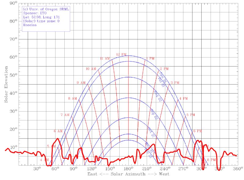
Performed a solar survey today. This is a check on the site of your solar panels to see what may obscure the sun at different times of the year.
To do this I produced a 300mm circle divided in 10° segments and put this on top of a tall stepladder so than when I stood on it my eyes were a similar level to the final panels. The stepladder was orientated to North-South Line (Used Google Earth to find a sight line). Then I used a inclinometer (in my case a electronic spirit level) to map the angle of the top of each item from horizontal around the circle and note them down. I then took a series of photos to get a panorama at the same level.
Stitching the photos together gave me this …

I then traced a line along the top of the obstacles (Faint Red line above). I Then got a SunChart from the University of Oregon (Lat.-Long. from Multimap/Google Earth). Then took the horizon line from picture and scaled it onto the Sunchart to get this :-

For more info see the Solar page.